
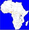
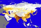
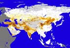
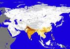
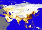
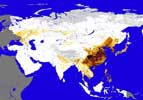
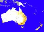
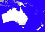
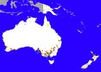
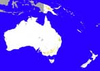
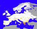
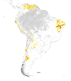
Livestock distribution maps: Regions
This section provides an indication of the density and distribution of livestock in various regions. Not all regions are presented, but as is the case with other sections, maps are continuously updated.
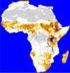 Cattle |
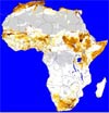 Sheep |
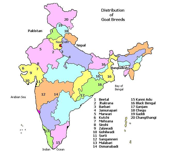
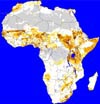 Goats |
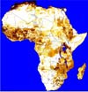 Chickens |
 Pigs |
| Click map for more details | ||||
| All densities are in heads per km2 | ||||
Maps were prepared by Kai Sonder (ILRI Addis Ababa, Ethiopia)
Disclaimer: Maps were drawn using the information available at the time of preparing this version of the AGTR. Maps will be updated in future versions when additional information becomes available.


 |